Many of the people opposing the Potrero Pedestrian Bridge are Canyon Rim residents, who claim they have never heard of the bridge. A bridge has been envisioned since at least 1985 and was in the final EIR* done for Potrero.
For a historical perspective, CTN spoke to Rob Weber and David Card, who were appointed to Potrero Canyon Community Advisory Committee by Councilmember Cindy Miscikowski in 2004. The first formal committee meeting took place in February 2005.
As part of a plan to complete the Potrero-fill project, lots could be sold after the canyon was stabilized (homes had slid off the rim of the canyon, necessitating the City to buy lots back from homeowners to settle lawsuits).
The Coastal Commission agreed to the plan, if money from the sales went to the completion of the park: a permit was issued in 1988. That permit was amended in 1991 and required access to the beach.
During the advisory meetings, “There were repeated discussions of the need for a crossing, and what form it would take—tunnel, bridge or at grade,” Weber said. “I favored an at-grade crossing with a pedestrian-controlled stop light as the solution that would be least expensive and easiest to implement.
“But, Caltrans has indicated on numerous occasions over the decades that it would NOT approve a crosswalk/stoplight on PCH at the bottom of the canyon,” Weber said.
A tunnel was mentioned, but the City’s Engineer, Rob Hancock, said there were too many known and unknown utilities under PCH.
In a subsequent 2005 Coastal Development Permit, the Coastal Commission was going to require the City to install a bathroom and a parking lot for 10-30 cars at the bottom of Potrero Canyon.

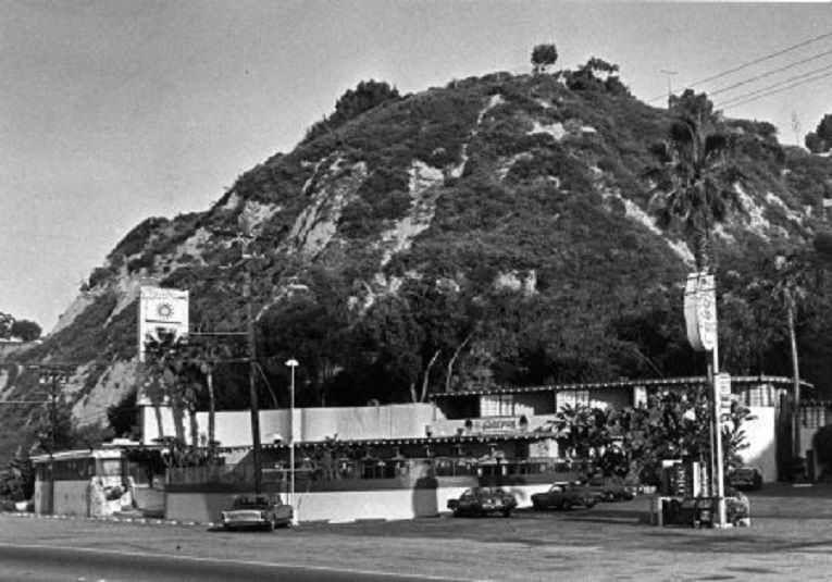
The Sunspot Hotel was located at the base of Potrero Canyon. This would be the proposed site for parking and for restrooms for Potrero unless a alternative, such as the pedestrian bridge was found.
“After several years of discussion, The Coastal Commission removed that condition, based in significant part on the fact that there would be a PCH crossing close to the existing lifeguard station bathroom and more than 1,000 parking spaces in the beach lot,” Weber said.
A feasibility study about Coastal Access was done by the City of Los Angeles in 2016 and it confirmed a bridge was the best option.
“Some rim residents who oppose the bridge may favor the six-tenths of a mile lateral trail which would go from the bottom of Potrero to Temescal Canyon Road to a stop light,” Card said. “Other rim residents are not in favor of either form of beach access.”
The lateral trail would run along Pacific Coast Highway, and the City would need to gain an easement from Caltrans, which it does not have, yet. Additionally, there are no plans for fencing to prevent people from accessing the Via de las Olas bluffs from that trail.
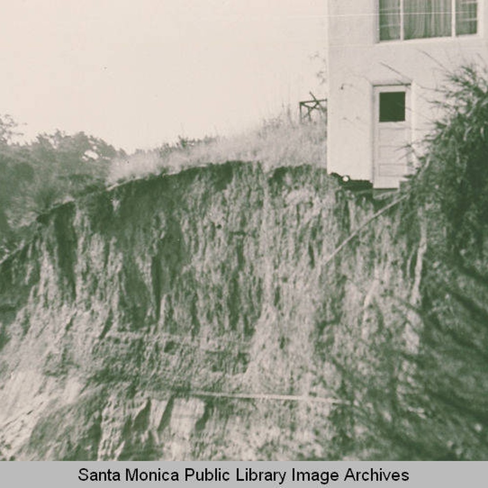
Card said, “I was an eyewitness to the huge 1958 Killer Landslide at the Via de la Olas bluffs, which buried a Caltrans worker, and dirt went all the way to the beach. The old PCH is still buried under that massive slide and the state had to create a new highway and beach to go around it.

Pacific Coast Highway used to run closer to Via de las Olas bluffs (left), but after the “killer slide” the roadway was moved closer to the ocean. A lateral trail is proposed to run next to PCH.
“Despite those risks, I still like a trail (in addition to a bridge), close to PCH, with a fence and earthen berm separating walkers from traffic,” Card said. “There could also be a fence on the bluff side of the trail.”
In a PPCC meeting, one representative said that if there were ever a threatening fire, he suggests that residents walk to the beach to escape a fire, rather than being caught in traffic jams.
To that Card said, “Amen. A pedestrian bridge would be the fastest, safest and most direct route to the relative safety of the beach if a fire storm like Lahaina is fast approaching and all the escape routes by car are grid locked.”
Weber and Card remind residents that “the park was paid for by all Los Angeles taxpayers and that public parks require access equity.”
“At the Farmers Market 10 days ago, two different people came up to the bridge informational table saying that they had heard about a lot of homeless in Potrero and at the Rec Center,” Weber said. “Later that morning I saw Officer Brian Espin and asked him how many reports LAPD has received about homeless camping in Potrero since it opened a year ago.
Espin told him, “Zero.”
CTN has heard from other residents that they don’t want an “open” park.
These people are listening to rumors and gossip, and not aware the entire park is fenced in and there is no after-hours access. The park is only open to the public from sunrise to sundown and those hours would not change with a pedestrian bridge.
Card said, “My message to Councilwoman Traci Park: Please let the Notice to Proceed be issued to Jacobs Engineering. Thank you in advance for what we hope will be your efforts to support the completion of the bridge project.”
Councilwoman Traci Park is holding a zoom meeting at 6 p.m. on December 5. Prior to the meeting Card and Weber urge residents to learn more about the history of George Wolfberg Park (https://wolfbergparkpotrero.org). To support the bridge send an email to councilmember.park@lacity.org and cc copy to wolfbergparkpotrero@gmail.com.

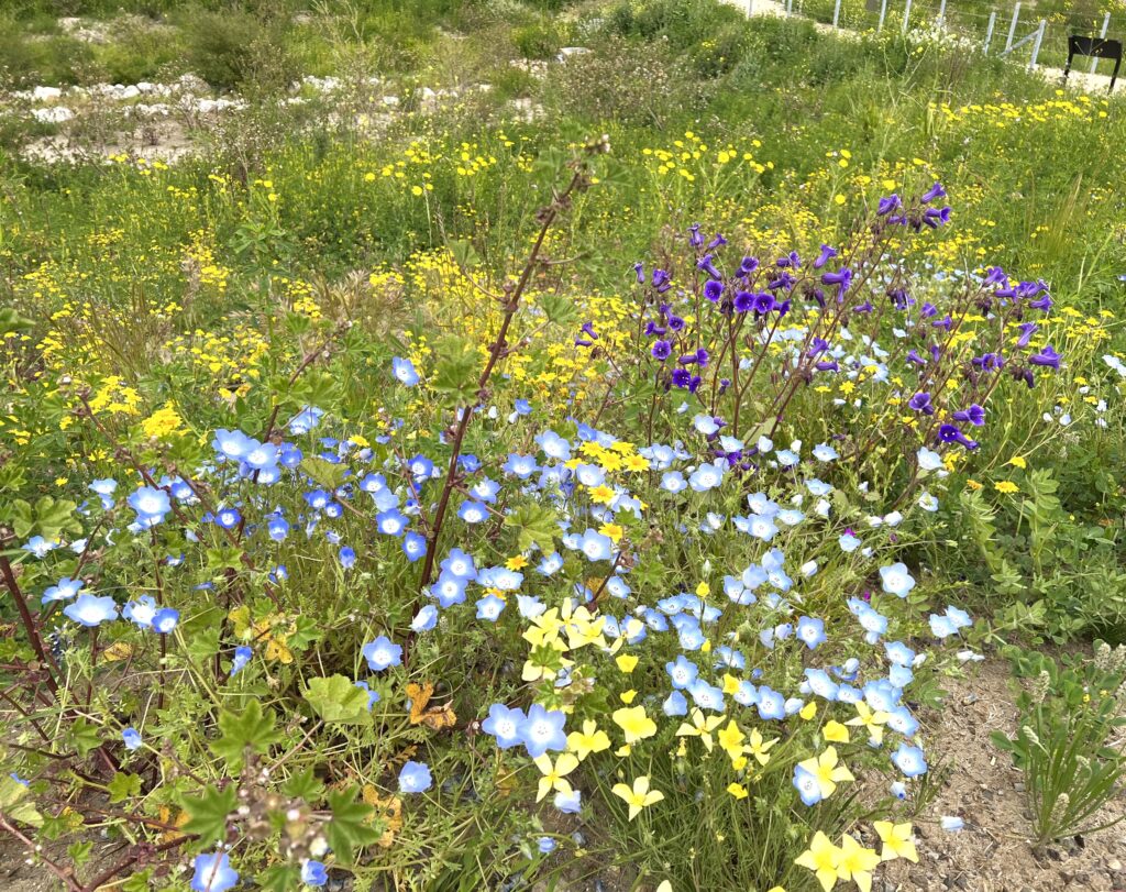
The mouth of Potrero Canyon Park abuts on Pacific Coast Highway and offers great views of the Pacific Ocean. Now there is money to build a pedestrian bridge across the highway, because the State is giving the City $11 million.
*The June 1985 Final Environmental Impact Report for Potrero Canyon Park Development Project contained the following:
“The Department of Recreation and Parks is planning for the canyon to serve as a scenic pedestrian accessway between the Palisades Recreation Center and the Will Rogers State Beach Park.” [Second sentence of the introduction];
“Principal objectives to meet in the development of Potrero Canyon Park are as follows: . . . develop a link between community and regional recreational facilities . . . integrate public safety and convenience with recreational uses . . . .” [EIR, p. II-1];
“PROJECT CHARACTERISTICS: As a means of developing Potrero Canyon for public recreation use the project will involve the conversion of the canyon into a pedestrian accessway for passage to Will Rogers State Beach Park from the Palisades Recreation Center. . . . A pedestrian overpass from the canyon mouth over Pacific Coast Highway to the State Park is also proposed for construction.” [EIR, p. II-4](emphasis added);
“When the fill operations are completed, a pedestrian bridge over Pacific Coast Highway, allowing safe access to Will Rogers Beach, is required to be constructed by the Sunspot Motel concessionaire.” [EIR, p. IV-49];
“The development of Potrero Canyon Park will serve as an [sic] pedestrian link from the Palisades Recreation Center to Will Rogers State Beach . . . Direct access to the beach from the canyon park will be by a pedestrian overpass over the Pacific Coast Highway.” [EIR, p. IV-55](emphasis added); and,
“Installation of a permanent pedestrian bridge over PCH would eliminate traffic dangers to pedestrians when crossing to the beach area facilities.” [EIR, p. IV-57](emphasis added).


Thank you for the real history of the canyon and the bridge
Residents should NOT count on the bridge as a way to get to the beach in case of a fire evacuation and the crowded roads. Remember the pathway to the proposed bridge is locked at sundown and has to be unlocked in the am! So the fire can’t interfere with those hours or people have to “jump, climb, or fly” over the locked gates to get to the bridge. Walking down Chautauqua or Temescal to a bridge over PCH seems much safer and more logical and cheaper.
You want the Alphabet Street residents to walk over to Temescal or Chautauqua, when the most direct route would be right through the canyon? Maybe you don’t remember the traffic gridlock the last time people had to evacuate Pacific Palisades–no one could drive down Temescal – and Chautauqua was backed up? Let the firefighters have a key to open the gate by Frontera and everyone can evacuate safely. One only has to look at the devastation at Lahaina and the cars that were burned, to know all residents need to be able to get out of this town if a fire comes through.
Build the bridge, it is safely away from the un-toed hillside where the slides are occurring. Ditch the lateral trail. And whoever has an ownership stake in the flats by PCH…CLEAN IT UP ! It looks like trash form the cliffs, from the highway, and from a new bridge, too.