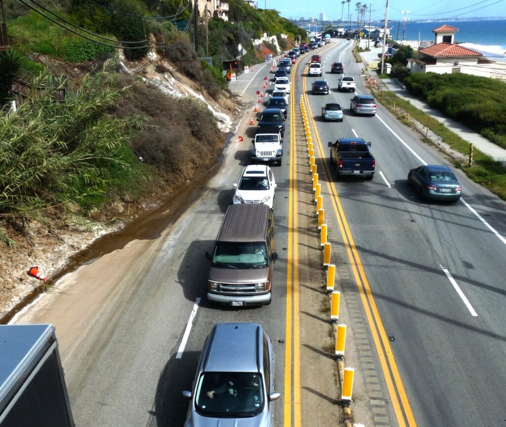
One northbound lane of PCH is closed below the Tramonto landslide located between Sunset Boulevard and Porto Marina, causing bumper-to-bumper traffic.
Photo: MURRAY LEVY
Hans Lantz at KBUU Radio in Malibu said on April 1 story that a northbound lane of PCH has been closed for weeks at Porto Marina.
He reported: “One block down the coast … the Porto Marina [Tramonto] landslide … the one blocking one lane of the road towards Malibu … continues to come down.
“That landslide has been inching into PCH traffic lanes for more than 30 years.
But this winter … it accelerated across the roadway … completely blocking the number two lane just past Sunset Boulevard.
“And three weeks later … there it sits.
“That landslide had taken out old city streets up the hill … decades ago.
“Caltrans tells KBUU they cannot clear the mud until it stops sloughing off private property uphill … private property that has been sliding down towards PCH as long as the highway has been there.
“There are 63 thousand cars . . . trucks and school buses use that section of PCH every day.
“On one side … the ocean has eaten away the side of the road.
“On the other side … nightly traffic jams because of a slow-moving mudslide that has been active for 60 years.
“Caltrans has not announced any plans about what it will do about the immediate threats to PCH … the main access to Malibu … carrying 63 thousand vehicles a day.”

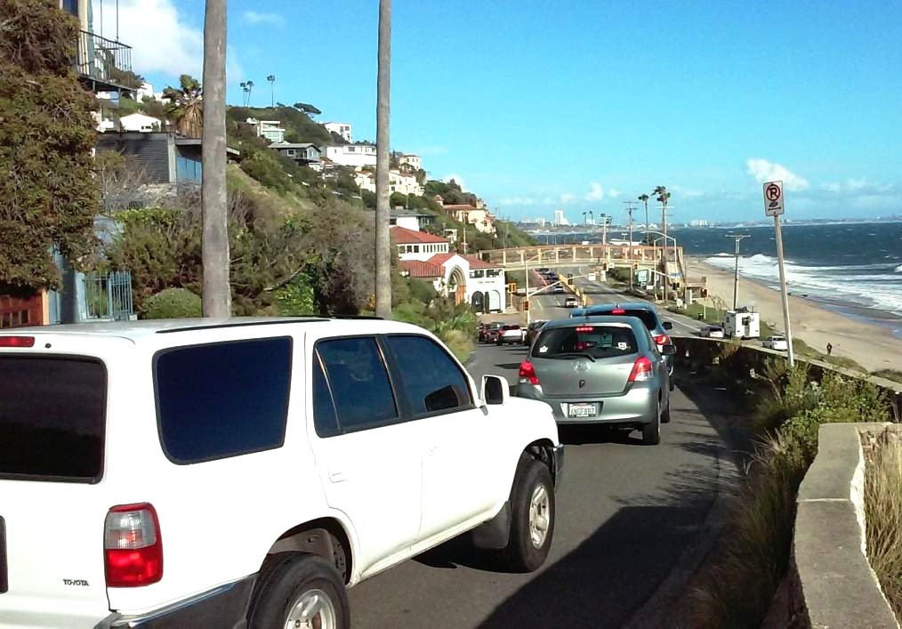
To avoid PCH, cars use apps like WAZE that takes traffic on narrow roads through Castellammare and down to the light at Porto Marino at PCH, causing a back up.
Photo: MURRAY LEVY
Castellammare neighbors are aware of the history of the Tramonto slide that took out homes and portions of three streets Posetano Road, Revello and Porto Marina Way in 1958. Portions of some of the pavement can still be seen from the Tramonoto bulkhead.
The bluff above PCH has more recently experienced slope failure in 1982, 1998, 2001 and 2005.
In November 2023, a developer argued that by building four large homes with pools and basements on top of the slide, that would stabilize the hillside.
Neighbors disagreed because they had read a 2010 report from URS Corporation/Caltrans/L.A. City DPW, Bureau of Engineering: “Soil-Structure Interaction Modeling of a Landslide-Stabilization Scheme” that included a proposed stabilization scheme for the Tramonto Drive Landslide.
During that 2010 investigation, there was geologic mapping, borings, downhole geophysics and instrumentation that included monitoring the slide movement specifically in that area.
The report showed a deep-bedrock failure plane between Posetano and Tramonto.
In that report, it was stated “avoid large-scale grading, use drainage for basic stability and use structural support, which mean excavating to bedrock and deeper with shotcrete and installing hydraugers.” Then the report suggested using solid reinforced concrete to the elevation of the hydraugers.
The 2010 land-stabilization scheme showed that there should be structural-support elements in place besides just excavating to the level of the bedrock.
The cost to reinforce that Tramonto slide area was estimated to be about $25 million in July 2010.
But on November 15, despite expert testimony to the contrary that the landslide needed to remediated first, the West Los Angeles Planning Commission approved the construction project, which included four large houses with pools and basements to be built on an active landslide between Tramonto and Revelo. The largest house is 9,051 sq. ft. with a 5, 887-sq.ft. basement and a pool and spa.
Councilmember Traci Park’s office spokesperson told CTN on April 5, “We’re still following the recommendations of planning. We rely on the expertise of Building and Safety. If new information comes up that would prompt new questions.”
Bart Young, the CEO of Falkenberg/Gilliam & Associates wrote to City Planning, on March 22 “You contend that building a new development on top of an active landslide will mitigate the Tramonto landslide situation.
“You said in December that this is done all the time in Los Angeles. Yet nothing I have found will support this theory that building homes on an active landslide will prevent future slides. Just the opposite.
“Please provide a list of locations where homes have been effective in stopping active landslides.”
Young adds that action needs to be taken to mitigate the landslide before construction begins or “we can expect a larger mess from continued slides on PCH that will cut off residents from their homes and employment for a long period of time.”
During the November 2023 hearing, one of the Commissioners asked if there was any history of successful building on active landslides in L.A. and was told by City officials there might be an example somewhere in Mt. Washington.
When the developer was asked to confirm that he has built successfully on a landslide, he said he had not, but claimed that Stony Miller had and cited the One Coast Condominiums (located in Pacific Palisades above Castellammare Drive and Sunset Boulevard).
Young wrote, “Ever since this project was completed three years ago it has bled water from the hill beneath it on a non-stop basis throughout the year. Why? It is doubtful that it is from a leaking pipe which can be fixed easily. It is unknown, but likely to be due to being built on a landslide … a river of mud below the surface.”
The water is flooding through the walls of the garage of the three-story structure at 17373-17383 Sunset Boulevard at Pacific Coast Highway.
When will the lane on PCH be opened?
One resident wrote on April 2, “the right northbound lane is still closed and probably will remain closed for several more weeks.”
Is the L.A. City Planning Commission listening about building on a landslide? Malibu and Palisades residents hope so.

These condos were built on a landslide and the water streamed down the hillside, above Castellammare on April 4, when CTN stopped by. Workers were putting up sandbags.

This hillside building has got to stop. Not safe!
Any update on restoring PCH? Can’t just leave indefinitely until hillside settles especially if hillside isn’t likely to settle or if private funding won’t realistically be available soon if ever. It causes a delay for up to an hour every day for thousands of travelers. It is even worse with Topanga Canyon closed and Malibu Canyon closed like they were today (from rockslides).
Here’s an update as of 4/16 … Maybe circling the news can interview Jim Medina and keep the pressure on getting this lane closure resolved.
The Malibu Canyon Road is much smaller and simpler to clear than the ones at Porto Marina and Topanga Canyon.
Here’s the latest on Porto Marina:
That is actually a city of LA slide. And that has been moving for years. It has been determined by geologists that removing will make the issue worse, potentially spreading onto the entire highway and causing a complete shutdown of PCH. We are working with the city’s consultant on this one. This area has been a problem for many years and one were we have kept removing material. This year, it has just been saturated, like many areas along PCH and in Ventura County.
I’ll have an update on the Topanga slide later today. I’m meeting with the geologist at the location.
As to fire season, the Los Angeles County Fire Department is responsible for making response plans while factoring in which roadways are limited or blocked.
And Caltrans doesn’t have access to the Nextdoor app. We post updates on Twitter (X) and Instagram. We also recommend motorists check Quickmap.dot.ca.gov for real-time road conditions.
Thank you.
Jim Medina
Public Information Officer
Caltrans – District 7
Cell – 213.276.3390
James.Medina@dot.ca.gov
Thank you Jim Medina. It is refreshing to hear someone in an official capacity to speak intelligently about the geology in our area. The City of Los Angeles has approved a new jumbo home development at the top of the Tramonto landslide. They propose to remove 34,000 cu. yards of dirt. This will require thousands of dump truck loads over many, many years. What they fail to understand is that landslide water is mostly below the surface. So it will become wetter as they dig deeper. I live next door to the Tramonto landside and I draw 50 gallons of water from a single well 40 feet below the street on a hot summer day. Why? Its not rainwater. The water comes from the top of the Santa Monica Mountains and flows naturally to the ocean. The Tramonto slide is a natural catch basin for that water and mud deep below the surface. Building big houses on it wont stop it no matter how many pins they use to hold the structures in place. The City of LA promised to mitigate the side 15 years ago. Instead, they sold the lots for cheap to a developer who claims full responsibility until they are sold. Since they no longer offer landslide insurance, these will need to be buyers with more money than brains. The LA City Council will be voting on this May 7. I wish you would weigh in on this proposed plan. Most experts won’t touch this for fear of being blackballed by other developers. Thank you Jim Medina for your honesty and integrity.
Please just at least provide a temporary fix to get this lane open. The traffic is horrendous and makes and is causing many immediate problems in people’s day to day lives.